
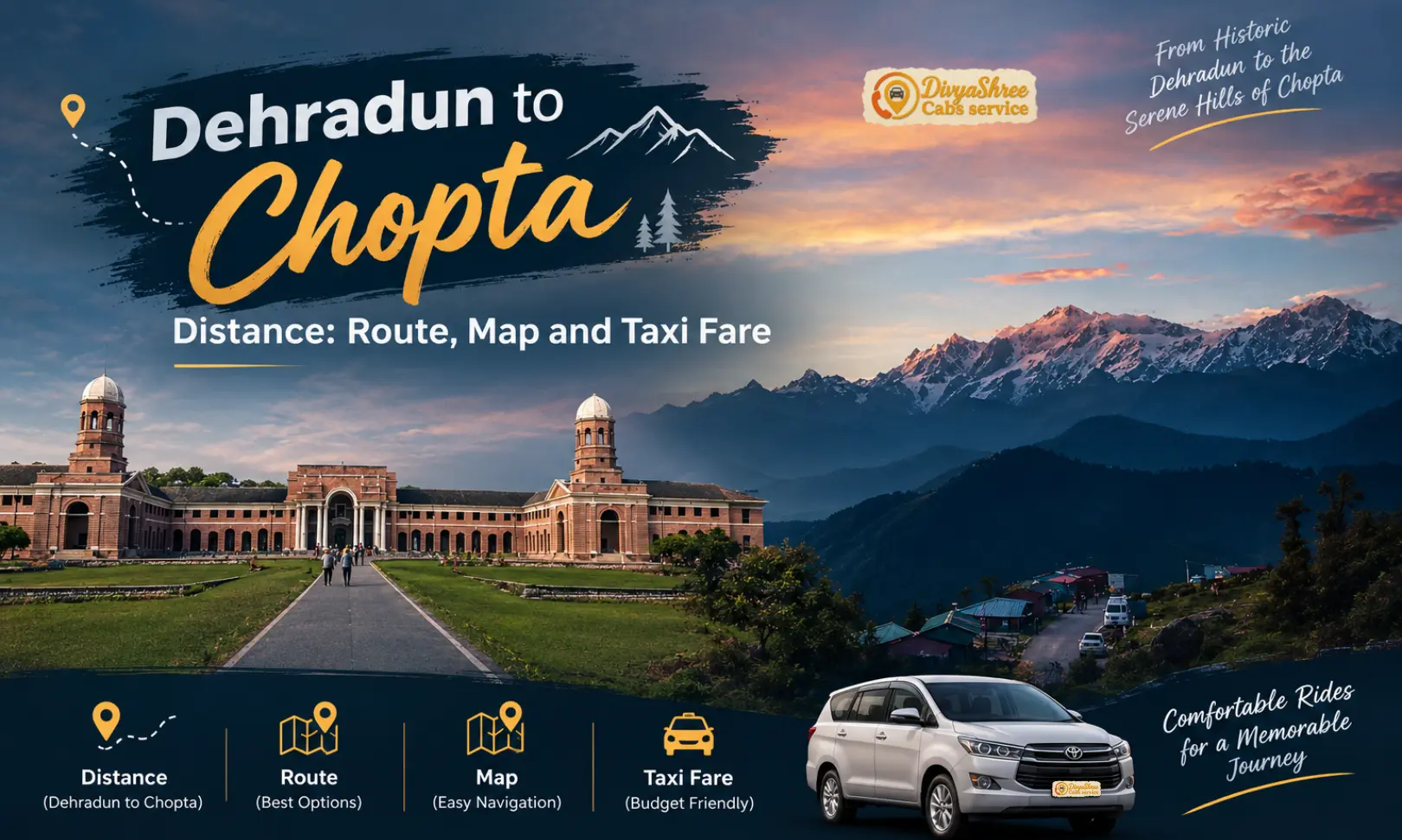
The Dehradun to Chopta distance is roughly 220–250 km by road, depending on whether you start from Jolly Grant Airport (the shorter figure) or from Dehradun city, and the drive usually takes 7–8 hours. The standard route runs through Rishikesh, Devprayag, Srinagar (Garhwal), Rudraprayag, and Ukhimath, and the road ends at Chopta itself — the last 3.5 km to Tungnath is covered on foot. A private cab is the most comfortable way to do it, since there is no train to Chopta and public transport usually means changing vehicles at Rudraprayag or Ukhimath.
Dehradun to Chopta: A Quick Introduction
Chopta is the trailhead for one of Uttarakhand’s most loved short treks. It sits at roughly 2,700 metres in the Rudraprayag district of the Garhwal Himalayas, surrounded by rhododendron and deodar forest and open alpine meadows that earned it the nickname “Mini Switzerland of Uttarakhand.” More than anything else, though, Chopta is the base for the climb to Tungnath, widely described as the highest Shiva temple in the world, and onward to the Chandrashila summit above it.
Most travellers heading there from the plains start in Dehradun, because Dehradun has the nearest airport (Jolly Grant) and good rail and road connections to Delhi. That makes the Dehradun to Chopta leg the practical first question for almost every trip: how far is it, how long will it really take, and what is the sensible way to cover it? The honest answer is that it is a full day on the road. The kilometre count looks modest, but this is mountain road almost all the way, so the clock matters more than the odometer.
In this guide we break down the Dehradun to Chopta distance by road stage by stage, explain the route and the towns on it, compare the ways of getting there, and cover the fare factors for a private cab, the Tungnath trek itself, and the best months to go. If you want a broader overview of every way to reach this region, our how to reach Chopta guide covers the full picture from other cities as well.
One thing worth keeping in mind from the start: Chopta is a trailhead and a stretch of meadow, not a town. There are camps, small hotels, and tea stalls, but the main services — ATM, hospital, wider choice of stays — are down the valley at Ukhimath. That shapes how you plan the drive, where you break the journey, and what you carry with you.
Distance Between Dehradun and Chopta (and Nearby Points)
Here is how the distance between Dehradun to Chopta compares with the other starting points travellers commonly use, plus the short walking legs once you reach the trailhead.
| Route | Approx. Distance | Approx. Time |
|---|---|---|
| Dehradun to Chopta (by road) | 220–250 km | 7–8 hrs |
| Chopta to Dehradun (return) | 220–250 km | 7–8 hrs |
| Dehradun Airport (Jolly Grant) to Chopta | ~220–230 km | 7–8 hrs |
| Rishikesh to Chopta | ~205 km | 6–7 hrs |
| Haridwar to Chopta | ~215–230 km | 7–8 hrs |
| Delhi to Chopta | ~400–450 km | 11–13 hrs |
| Rudraprayag to Chopta | ~65–70 km | 2–2.5 hrs |
| Ukhimath to Chopta | ~30 km | 1 hr |
| Chopta to Tungnath (trek) | 3.5 km | 1.5–2.5 hrs on foot |
| Tungnath to Chandrashila (trek) | 1.5–2 km | 45–90 mins on foot |
These are approximate road distances, and different sources vary by 10–25 km depending on the pickup point and the exact route. The shorter end of the Dehradun range applies from Jolly Grant Airport; the longer end from Dehradun city. Drive time depends on traffic through Rishikesh, weather, and road works, so always confirm current conditions before you set out. For a wider look at routes into Uttarakhand, see our Chopta route and distance guide.
Dehradun to Chopta Route: The Map at a Glance
If you are picturing the Dehradun to Chopta route on a map, it helps to know that there is really one sensible way to do it. You come down out of Dehradun towards Rishikesh, join the Rishikesh–Badrinath highway, follow the Ganga and then the Alaknanda upstream, and turn off near Rudraprayag onto the Mandakini valley road that leads to Ukhimath and Chopta.
Dehradun → Rishikesh → Devprayag → Srinagar (Garhwal) → Rudraprayag → Ukhimath → Chopta → Tungnath (trek)
The road is national highway up to Rudraprayag and a narrower state and national highway stretch beyond it. Fuel pumps, dhabas, and hotels are easy to find through Rishikesh, Srinagar, and Rudraprayag; after Ukhimath services thin out quickly. This is also why most drivers like to fill the tank and have a proper meal before the last climb, rather than assuming everything will be available at the top.
Dehradun to Chopta by Road: Stage-by-Stage Breakdown
The road journey follows the Ganga, then the Alaknanda, then the Mandakini valley, climbing steadily before the final stretch into Chopta.
From the airport it is about 15 km; from Dehradun city roughly 40 km. This is the easy, flat opening to the day and the best time to settle in and confirm your plan with the driver.
The road follows the Ganga upstream to Devprayag, the sacred confluence where the Alaknanda and Bhagirathi meet and the Ganga takes its name.
A winding stretch along the Alaknanda to Srinagar, one of the larger towns on this route, with fuel stops, eateries, and a good place for a proper lunch break.
The highway continues beside the Alaknanda to Rudraprayag, the confluence with the Mandakini and the point where the Kedarnath and Badrinath routes part ways.
Here you leave the Badrinath highway and follow the Mandakini valley, then branch off towards Ukhimath, the winter seat of Kedarnath and the last town with regular services before Chopta.
The final climb into the forest and meadow country. The road gains height steadily and the temperature drops noticeably as you near the top. The road ends at Chopta.
Beyond Chopta there is no road. The 3.5 km stone path to Tungnath Temple begins right beside the main road, with another 1.5–2 km to the Chandrashila summit.
The stages from Rishikesh to Chopta add up to about 205 km, which matches the commonly quoted Rishikesh–Chopta figure. Add the airport or city leg at the start and you arrive at the 220–250 km range for the full drive. Segment distances are approximate and vary slightly with the exact roads your driver uses.
Dehradun to Chopta Valley Distance: What the Kilometres Do Not Tell You
Searches for the Dehradun to Chopta valley distance usually come from people trying to judge how demanding the trip will be. The short version is that the figure of roughly 220–250 km understates the effort. Because the road climbs from about 600 metres in the plains to around 2,700 metres at the top, and because much of it is single-carriageway hill road with hairpin bends and slower trucks, an average speed of 30–35 km/h is realistic for the whole day.
The valley itself is a high-altitude stretch of forest and meadow rather than a single settlement. Locals and guides use “Chopta” for the whole area along the road, which includes the small cluster of camps and shops at the trailhead, the meadows of Duggalbitta a little below, and the paths leading up towards Tungnath. When you see a stay advertised as being in “Chopta,” it can be anywhere along that stretch, so it is worth asking how far it is from the main trailhead.
Another practical point is that the final 30 km from Ukhimath is slower than the numbers suggest. In winter and early spring, snow can make this stretch slower still, and in monsoon it can be affected by landslides. That is why we always recommend building a generous buffer into your plan rather than treating the 7–8 hour estimate as a guarantee.
How to Visit Chopta from Dehradun
There is no railway line or airport at Chopta. Every route ends the same way — by road to the trailhead, then on foot to Tungnath.
Door-to-door from Dehradun city, the railway station, or Jolly Grant Airport, with flexible stops and no vehicle changes. The easiest choice for families, groups, and anyone short on time.
Buses run towards Rishikesh and onward to Rudraprayag and Ukhimath; from Ukhimath, shared vehicles go up to Chopta. It is cheaper but slower, with fixed timings and several changes.
Possible for confident hill drivers, since the road is open to cars all the way to Chopta. It is a long, tiring day, and winter driving needs extra caution.
Can We Go to Chopta by Car?
Yes. Chopta is connected by a motorable road, and cars, SUVs, and tempo travellers can all reach the trailhead in normal conditions. That is one of the reasons it is so popular for weekend and short-break trips. The road ends at Chopta, so vehicles cannot go any further — the walk to Tungnath begins on foot from there.
What matters more than the vehicle type is the driver’s experience with hill roads. The stretch beyond Ukhimath has tight bends, and after rain or snow it can be slippery. For a first trip, hiring a cab with a driver who knows the road well is usually less stressful than driving yourself after a long day. If you do self-drive, start early, avoid driving after dark, and keep a close eye on weather updates, especially in winter and monsoon.
Dehradun Airport to Chopta: Planning Your Arrival
Many visitors fly into Jolly Grant Airport, which means the Dehradun airport to Chopta transfer is the first leg of their trip. It is roughly 220–230 km and 7–8 hours by road, so an early-morning flight makes a big difference. If you land by mid-morning, you can still reach the Ukhimath or Chopta area by evening, which sets you up nicely for a dawn start on the trek the next day.
If your flight lands in the afternoon or evening, it is wiser to break the journey instead of pushing on in the dark. Rudraprayag and Srinagar both have a good spread of hotels, and an overnight stop there lets you cover the final stretch in daylight the next morning. Our drivers are used to airport pickups and can coordinate around flight delays, so share your flight details when you book.
Best Taxi Service for Chopta & Uttarakhand Tours
DivyaShree Cabs is built to be a dependable taxi service for Char Dham routes, hill stations, and trekking trailheads across Uttarakhand — including long mountain routes like Dehradun to Chopta. Here is what travellers value most when they book with us.
Drivers experienced on the Rishikesh–Rudraprayag–Ukhimath corridor and the final climb to Chopta.
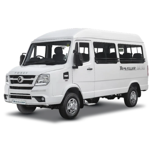
Sedans, Ertiga, Innova/Crysta, and Tempo Travellers, serviced and ready for long hill journeys.
Clear, confirmed pricing on call — no last-minute surprises on your route or vehicle.
Easy booking and trip support by phone or WhatsApp at 9368028472, before and during your trip.
Pickup from Jolly Grant Airport, Dehradun railway station, or your hotel, timed around your arrival.
From small groups heading to Tungnath to families on a Garhwal holiday, our vehicles fit both.
Hire a Taxi from Dehradun to Chopta
We run sedans, MUVs, SUVs, and tempo travellers for the Dehradun–Chopta route, with pickup available directly from Dehradun city, the railway station, Jolly Grant Airport, or your hotel. Fares vary by season, vehicle, and trip length — call for a confirmed quote before booking.


Dehradun to Chopta Taxi Fare Guidance
The Dehradun to Chopta taxi fare depends on the vehicle, the pickup point, and whether you want a simple drop or a round trip with waiting days. The table below is a planning guide only — always confirm the exact fare on call before booking.
| Vehicle | Use Case | What Affects Fare |
|---|---|---|
| Sedan | 1–4 travellers, budget trip | Season, one-way vs. round trip, waiting days at Chopta |
| Ertiga | 4–6 travellers | Same as above, plus luggage load |
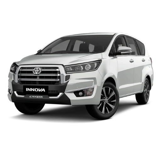
| Innova / Crysta | Up to 7 travellers | Peak-season demand, number of overnight halts |
| Tempo Traveller | 9–17 travellers | Group size, multi-day itinerary, toll & parking |
Prices may vary by season, vehicle condition, fuel rates, and availability, and typically run higher during peak trekking months and holiday weekends. Because the trip is long and mostly uphill, fares depend heavily on whether you want a one-way drop, a return with waiting time, or a multi-day package.
Why Book a Dehradun to Chopta Cab
A Dehradun to Chopta cab removes the biggest friction points of the trip. You skip the bus-stand waiting, the change at Rudraprayag or Ukhimath, and the uncertainty of finding a shared vehicle for the last 30 km. You also get control over timing: leaving at 6 AM instead of whenever the next bus departs can be the difference between reaching Chopta in daylight and arriving after dark.
For families with children or older relatives, a private vehicle also means you can stop when needed, carry more luggage, and avoid crowded seating on long winding roads. For groups, a tempo traveller keeps everyone together and often works out better value per head than several separate tickets.
If you prefer to compare options, a Dehradun to Chopta taxi booked in advance is usually the most predictable choice in peak season, when seats and vehicles fill up quickly. Tell us your dates, group size, and whether you also want to visit nearby spots such as Ukhimath or Deoria Tal, and we will quote accordingly.
Chopta to Dehradun: Planning the Way Back
The Chopta to Dehradun distance is the same as the way up — roughly 220–250 km and 7–8 hours — but it tends to feel different. After a dawn trek and a night in the mountains, most people are tired, so it helps to plan the Chopta to Dehradun drive for the morning rather than leaving it late. Leaving by around 8–9 AM usually gets you back to Dehradun by late afternoon or early evening.
If you have a flight or train to catch from Dehradun, build in a safety margin of at least a few hours. Landslides in monsoon, snow in winter, or a long queue of vehicles at a narrow stretch can easily add an hour or two. Many travellers book a one-way drop in advance and arrange a return pickup separately, which is a good option if your plans might change after the trek.
Dehradun to Chopta Tungnath: The Trek That Makes the Journey Worthwhile
For most people, Dehradun to Chopta Tungnath is one trip: the long drive, then the short, rewarding climb. The trek from Chopta to Tungnath Temple is about 3.5 km one way on a well-laid stone path that starts right beside the road. Most people take 1.5 to 2.5 hours to reach the temple, depending on pace and conditions. From Tungnath, another 1.5–2 km of steeper climbing leads to Chandrashila, where, on a clear morning, the views of the high Himalayan peaks are the main reward.
The path is steady rather than technical. There is no rock climbing or exposed scrambling, but the altitude (the temple sits above 3,600 metres) and the steady uphill gradient mean you feel it, particularly on the last stretch to Chandrashila. Starting early is the single best piece of advice: the morning light is clearer, the weather is usually more stable, and you avoid the afternoon clouds that tend to roll in.
Is the Chopta Trek Difficult, and Can a Beginner Do Tungnath?
The Chopta–Tungnath trek is generally rated easy to moderate. The distance is short, the path is well defined, and there are tea stalls along the way where you can rest. That is why it is one of the most popular first treks in Uttarakhand. Chandrashila adds a more demanding final section, but it is still within reach for a reasonably fit beginner who goes slowly.
A beginner can do the Tungnath trek comfortably with basic preparation: wear proper trekking shoes, carry a light backpack, start early, drink water regularly, and take short breaks rather than long ones. Anyone with heart, breathing, or knee problems should check with a doctor first. The trek is not considered especially risky in fair weather, but conditions change quickly at altitude — snow, ice, fog, or heavy rain can make the path slippery. In those conditions, it is wiser to turn back or wait than to push on.
Best Time to Visit Chopta
Chopta can be visited most of the year, but each season gives a very different experience. The most commonly recommended windows are March to June and September to November.
Spring and early summer bring pleasant weather, clear mornings, and blooming rhododendron in the lower forests. Popular with first-time trekkers.
Monsoon brings green meadows but also heavy rain, fog, and landslide risk on the road. Best avoided unless flexible.
Post-monsoon skies are often the clearest of the year, with crisp air and good mountain views. Many consider this the best window.
Cold, with regular snowfall. Beautiful, but the trek can be slippery or closed in heavy snow, and the road may be affected.
Is There Snowfall in Chopta?
Yes. Chopta gets regular snowfall in winter, typically from around December through February, and sometimes into March at higher points. That is exactly why many travellers choose to visit then — the meadows turn white and the trek takes on a completely different character.
The trade-off is practical. Snow can slow the road beyond Ukhimath, make the trek slippery, and in heavy snowfall the route may be closed or become unsafe. Winter is best for travellers who have flexibility with dates, warm gear, and an experienced local driver. If snow is the main goal, we suggest staying at Ukhimath or a nearby lower point and checking conditions each morning before heading up.
Which Is the Best Month to Visit Chopta?
If you want one answer, September to November and March to May are the most reliable windows. Spring offers rhododendron blooms and mild days; autumn offers the clearest skies. Peak summer weekends can be busy, and monsoon is the riskiest period for road travel.
For travellers chasing snow, January and February are the most dependable months, though conditions vary from year to year. Whatever month you choose, avoid assuming that the weather you see in Dehradun will match what you find at 2,700 metres — it can be 10 to 15 degrees colder at the top and change within hours.
How to Plan a Chopta Trip from Dehradun
A relaxed plan is two nights and three days. It keeps the driving manageable and gives you a full, unhurried morning for the trek.
Leave Dehradun early, break at Srinagar for lunch, and reach Ukhimath or Chopta by evening. Settle in, have an early dinner, and rest.
Start the trek at dawn, reach Tungnath and Chandrashila, return to Chopta by midday, and optionally visit Deoria Tal or Ukhimath in the afternoon.
Leave Chopta in the morning for the 7–8 hour drive back, arriving in Dehradun by evening.
Add Omkareshwar Temple at Ukhimath, or continue towards Madhyamaheshwar via our Madhyamaheshwar temple guide.
Staying in Ukhimath vs Chopta
Chopta has camps and a handful of small hotels right at the trailhead, which is perfect if you want to start walking at first light. The trade-off is limited facilities: fewer food options, patchy network, and fewer backup choices if something goes wrong. Ukhimath, about 30 km below, has more hotels, an ATM, a hospital, and better connectivity.
Many travellers split the difference: stay at Ukhimath on the way up, and spend one night at Chopta close to the trek. In peak season and holiday weekends, rooms fill early, so book ahead or let us help you coordinate stays with your cab.
How Is the Road Condition from Rishikesh to Chopta?
Most of the road from Rishikesh to Rudraprayag is a well-used national highway, and you can generally make steady progress. Beyond Rudraprayag, the road narrows and becomes more winding as it climbs towards Ukhimath and Chopta. Conditions are usually fine in fair weather, but this is a mountain road, so patches of damage, narrow stretches, and slow-moving traffic are normal.
The main risks are seasonal: landslides in July and August, slippery surfaces after rain, and snow or ice in winter. Avoid driving after dark where possible, keep the fuel tank topped up, and check with locals or your driver about current conditions before the final stretch.
Altitude, Health, and Safety Tips
Chopta sits around 2,700 metres and Tungnath above 3,600 metres, which is high enough for mild altitude effects such as headache, breathlessness, or fatigue, especially if you rush. Walk at a steady pace, stay hydrated, and avoid heavy meals or alcohol on the evening before the trek.
Anyone with a heart condition, severe asthma, or other chronic issues should consult a doctor beforehand. Carry basic first-aid, personal medicines, and enough warm layers — temperatures drop quickly once the sun goes down, even in summer. The last ATM and the nearest hospital are at Ukhimath, so plan your cash and any medical needs before heading up.
What to Pack for Chopta
A fleece, a windproof jacket, and thermals — nights are cold even in summer.
Broken-in, grippy footwear for the stone path, plus spare socks.
A poncho or raincoat, since weather in the hills changes quickly.
Withdraw cash before leaving Ukhimath and carry a valid photo ID.
Personal medicines, pain relief, and any altitude-related advice from your doctor.
A refillable bottle, light snacks, and a headlamp for early starts.
Travel Tips for the Dehradun–Chopta Journey
Leave Dehradun by 6–7 AM so you reach the hills in daylight.
Stop at Srinagar or Rudraprayag for a proper meal and a rest.
Cabs and rooms fill quickly on weekends and holidays.
Top up before Ukhimath, where options are limited.
Look at forecasts for Chopta specifically, not just Dehradun.
Landslides or snow can delay the return, so avoid tight connections.
What to See Around Chopta Besides Tungnath
Most people come for Tungnath, but the area has a few other stops that fit easily into a two-night trip. Deoria Tal, a small mountain lake reached by a short trek from the village of Sari, is a popular add-on for its reflections of the Chaukhamba range on a clear morning. The meadows around Duggalbitta, just below Chopta, are good for an easy evening walk when you are tired from the road.
Further down the valley, Ukhimath is worth a stop for Omkareshwar Temple, where Kedarnath is worshipped during the winter months when the main shrine is closed under snow. If you have a spare half day, it adds a quiet cultural layer to a trip that is otherwise about mountains and views. A local driver can fold these stops into your route, so mention them when you book.
Because distances between these places are short but the roads are slow, it is better to pick one or two extras rather than trying to see everything. A relaxed pace is what makes the Chopta trip enjoyable, especially after a long drive from Dehradun.
If you are travelling with children or older family members, keep the extras to the gentle ones, such as the meadow walks and Ukhimath, and save the lake trek for a group that is comfortable on forest paths. Whatever you choose, carry water and snacks, since shops thin out quickly away from the main road.
Combining Chopta with Other Uttarakhand Destinations
Because Chopta sits on the same Mandakini valley corridor as Ukhimath, it pairs naturally with nearby spiritual and scenic stops. Many travellers visit Omkareshwar Temple in Ukhimath, the winter seat of Kedarnath, and some continue towards Madhyamaheshwar, one of the Panch Kedar temples — see our how to reach Madhyamaheshwar temple guide for that route.
For a longer circuit, you can combine Chopta with Kedarnath and Badrinath, since the routes branch off from Rudraprayag. If you are starting your trip with a stay at a hill station, Mussoorie is a popular add-on before or after the Chopta leg. Keep in mind that each extra stop adds driving time on slow hill roads, so a realistic plan usually covers one major add-on per trip rather than several, leaving room for weather delays and a comfortable pace.
Share your full itinerary when you call, and we will plan the cab around every leg instead of booking each one separately. You can also explore more of our services on the DivyaShree Cabs home page.
Dehradun to Chopta FAQs
Is there snowfall in Chopta?
Yes. Chopta typically gets snowfall from around December to February, sometimes into March. It is beautiful, but the road and trek can be slippery or temporarily closed, so check conditions first.
Why is Chopta famous?
Chopta is famous for its alpine meadows, forests, and as the base for the Tungnath–Chandrashila trek. Tungnath is widely described as the highest Shiva temple in the world, and Chopta is often called the “Mini Switzerland of Uttarakhand.”
Which city is closest to Chopta?
Among the cities with rail and air links, Rishikesh (about 205 km) is the closest, followed by Haridwar and Dehradun. The nearest small town with services is Ukhimath, about 30 km away.
Which is the best month to visit Chopta?
September to November and March to May are the most popular windows. January and February are best for snow, while July and August are the riskiest because of monsoon rain and landslides.
How far is Rishikesh from Chopta Tungnath?
Rishikesh to Chopta is roughly 205 km by road, taking about 6–7 hours. From Chopta, Tungnath is a further 3.5 km trek on foot.
Is the Chopta trek difficult?
It is generally rated easy to moderate. The Chopta–Tungnath section is short and well laid, while the extra climb to Chandrashila is steeper. Most reasonably fit beginners can manage it with a slow pace.
How to plan a Chopta trip?
Plan two nights and three days: drive up on Day 1, trek on Day 2 at dawn, and drive back on Day 3. Book your cab and stay early in peak season and keep a spare day in monsoon or winter.
Is the Tungnath trek risky?
In fair weather it is considered safe for reasonably fit trekkers. Risk rises with snow, ice, fog, or heavy rain, so start early, carry warm layers, and turn back if conditions worsen.
How far is Haridwar from Chopta?
Haridwar to Chopta is about 215–230 km by road, usually 7–8 hours, following the same Devprayag–Rudraprayag–Ukhimath route.
How to visit Chopta from Dehradun?
Take a private cab or taxi by road via Rishikesh, Devprayag, Srinagar, Rudraprayag, and Ukhimath, a drive of roughly 220–250 km. Public transport is possible but usually involves several changes.
Where is Chopta Mini Switzerland?
Chopta is in the Rudraprayag district of Uttarakhand’s Garhwal Himalayas, and is the place most commonly called the “Mini Switzerland” of the state because of its meadows and mountain views.
Can we go to Chopta by car?
Yes. Chopta is connected by a motorable road, so cars, SUVs, and tempo travellers can reach the trailhead in normal conditions. Beyond Chopta, the way to Tungnath is on foot only.
Can a beginner do the Tungnath trek?
Yes. With proper shoes, an early start, and a slow pace, most beginners can complete the 3.5 km trek to Tungnath. The extra climb to Chandrashila is steeper but still achievable for many.
How is the road condition from Rishikesh to Chopta?
Mostly good national highway up to Rudraprayag, then narrower and more winding towards Ukhimath and Chopta. Expect hairpins, slow traffic, and occasional damaged patches, especially after rain or snow.
Leave A Comment